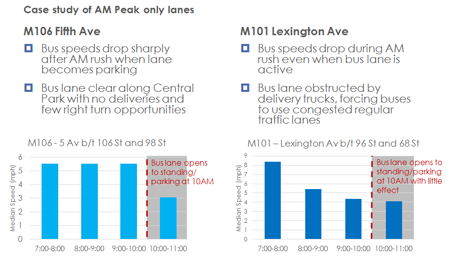
We were tasked to examine bus lanes in New York City for differences in enforcement needs based on actual bus speed data from GPS-based automated vehicle locator (AVL) systems. In New York, bus lanes are utilized for a number of different purposes, such as hosting right turn traffic, permitting commercial loading activities or even on-street parking during off-peak periods, etc. By comparing average bus speeds by time-of-day over specific street segments, we were able to determine which bus lanes had the most severe impact from those non-bus activities. More importantly, we were also able to determine which bus lanes saw the highest frequency of likely violations, by comparing the peak and off-peak bus travel times. Using this information, the Department of Transportation was able to target enforcement activities during the time-of-day and on the specific street segments where it was likely to yield most return on enforcement dollars invested.